Air prospection implies, at the time of discovery of indices favorable to the existence of an archeological site, that photographs are taken. To facilitate later identification of it, one records with a tape recorder the exact references for images " film number xxxxxx, view 24 to 28 ", as well as precise elements of localization. " 3 or 4 km south of Niort " are not enough. We can admit " Map IGN number 1432, crossing of D 129 and D 730, towards the km Lambert 355 and 2066. But for that, you should know where you are! Experts will understand me. An air prospection is seldom done in straight line, while following a definite plan (except perhaps at the time of study of ancient ways). Generally, it is the nature of ground, cultures and vegetation that will control: one always seeks the maximum zones of visibility of indices. Thus, left to explore the hydrographic network and valleys of such river, you find yourself " plowing " large opened plains, " champagnes ", quite simply " because it is good. But already one or more hours ago passed since the departure and the prospector did not follow his evolutions with all the desirable attention: he is lost!
The procedure in this case is simple. It is enough to take a certain altitude, 15 or 1800 feet and to examine carefully surrounding landscape by seeking characteristic elements: railways, motorways, main roads, rivers, until you found identifiable elements on a 1/250 000e card, for example. From there you will walk on a 1: 50 000e card until you will be able to define the position of a site. Pay attention however to keep the site in view at the time of the catch of altitude! It could become very difficult, even impossible, to find it...
But things always do not occur like that, and as a modern prospector, you regularly use the help of a GPS. You have it installed on board before each departure on a mission. Then it will be so much simpler, for the localization part of the message tape recorder, to press on the key " Autostore " of the GPS at the time of passage on the site and to announce " Point 324 ". Back to office, the GPS will restore the geographical co-ordinates of the site, on simple call of its number.
Concerning the Lambert co-ordinates, a conversion program of geographical co-ordinates into Lambert (France only), from A. Elinik., can also be used.
Problem of way-points
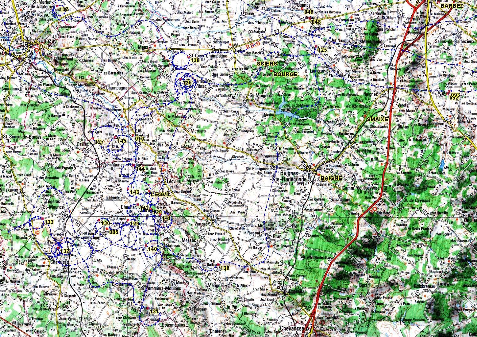
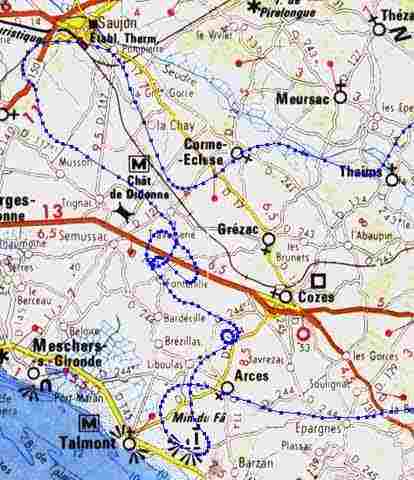
Problem of way-points, a major problem, arises to the air prospector, beginner or confirmed: the existence of sites discovered before and officially declared to the Official Authorities (page " Regulation "). It would be so discouraging to go on the assumption that you have made original discoveries and to realize later that they are well known, declared sometimes since decades and even excavated and published...
Problem exists: it was appropriate to look for a solution to him. This one is brought to us by the technique of the GPS. Those are able to record a certain number of points on the ground, the way-points, and to restore them later on. It is enough to record the position of all former discoveries so that, in flight, the GPS provides the position of the closest WP instantaneously! You will see the courses moving and outdistances it to decrease as you approach the position of a site already recorded. If distance falls below a hundred meters, it means that the site is already recorded and it is useless to waste time to turn around and make new photographs! In plane, every minute: cling... it is a part of two dollars which one has just spent! Time, more than elsewhere, is directly money...
All would be perfect in best of the Worlds if... our data base, in Poitou-Charentes, did not included already more than 3000 sites. And the majority of current receivers GPS accept only 250 to 500 WP... Well, here again resort to a professional hardware (9000 WP!) solves the problem, but it is more expensive... A little bit more...
|
|
|
|